Photo via WCNC Charlotte
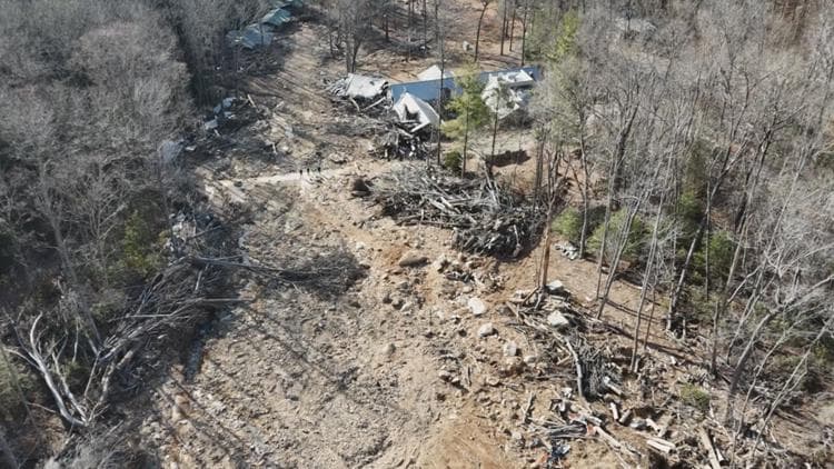
North Carolina's efforts to map landslide-prone areas faced repeated stops and starts due to political disagreements, leaving residents in vulnerable regions without access to essential hazard information years before Hurricane Helene struck western North Carolina. According to WCNC Charlotte, this on-again, off-again program created significant gaps in public safety infrastructure that could have informed land-use decisions and emergency preparedness in high-risk mountain communities.
The timing proved catastrophic when Helene arrived, as the absence of comprehensive landslide mapping meant that property owners, developers, and local governments lacked detailed risk assessments for planning and safety purposes. For Charlotte-area real estate professionals and investors with mountain properties or regional exposure, the incident underscores the risks of incomplete geological surveys and the business implications of incomplete environmental data during property transactions and development planning.
The aftermath of Helene's 31 landslide-related deaths has renewed scrutiny on the state's approach to natural hazard mapping and infrastructure resilience. Moving forward, more robust and politically insulated mapping programs could help protect both lives and property values across North Carolina's diverse terrain, particularly benefiting the western region's real estate and development sectors through better risk transparency and informed decision-making.